Learn how the landscape was shaped in Flockton.
The walk around Flockton sees the transition from the Lower Coal measures of West Kirklees, to the Middle Pennine Coal measures that are found towards Barnsley and Wakefield. Although the contrast in bedrock geology is actually nominal, this transition has influenced the landscape, with coal mining having been more intense and more recent to the East of here. Furthermore, the glacial front of the last ice, 17000 years ago, was found just beyond Bretton and Osset, creating a stark contrast between landscape to the East and West of Flockton.
Although there is no exposed geology on this circuit, there is a lot to be understood from the impressive landscape, and the sites of now defunct collieries.
The walk begins in Flockton villiage, and as you pass the church and school (bequeathed to Flockton by wealthy 17thcentury mine owner Richard Carter) you are standing upon the Birstall Rock; a sandstone unit of the Pennine Lower Coal measures, composed of fine bands of mudstones, siltstones, and important coal seams, deposited in a Carboniferous delta 310 million years ago. If you look to the South West, you will see Emley Moor mast which also stands on the Birstall Rock, providing a necessary flat and stable plateau.
The area surrounding Flockton contains 6 economically important coal seems that were easily accessible at the surface for simple drift mining, and at relatively shallow depths for early collieries. Indeed, Flockton can certainly claim to be a historic mining community, with one of the first known coal mines in the Huddersfield district to have been operational in 1515, with mines descending to 300 feet by the 1700s, which was a significant depth for the time, confirming Flockton as an important industrious settlement.
Further along the circuit, you will come to Flockton Beck at Common End. The most striking thing about this small stream is the bright orange colour. This indicates that some of the river water has permeated a layer of iron rich rock.Carbonate iron nodulesknown asSideriteare often associated with the coal of delta sequences, and so in an area in which coal seams have been disturbed, iron content can leech into the shallow groundwater of thevadose zone.
Continuing around the route, past the site of the Six Lanes End Colliery and tramway to the right, as you turn down Cranshaw Lane you will climb uphill to the highest point of the circuit, to stand upon the highest unit of rock in the entire 602 meter sequence of the Pennine Lower Coal Measures - The Emley Rock. Remember however, that this doesn't necessarily indicate the highest peak, as the rocks have a regional dip.
At the top of the Emley Rock is an importantstratumknown as the Tankersly Ironstone that contains an abundance of the fossil bivalve Carbonicola. Fossils like this can be used to date a rock unit, and are known aszoning fossils.
Further along, as you cross back over Flockton Beck you will walk past the site of ancient bell pits to the left, that exploited this accessible iron resource. These pits were worked by Monks from Riveaux and Fountains abbey in the 12thcentury. Indeed, mining in Yorkshire was the preserve of monastic communities until their dissolution in the 16thcentury, at which point the prospecting industry we know today began to develop. The proximity of iron workings to the field run off into the beck also explains the discolouration of the river water in the area.
You have now crossed over into the Middle Coal Measures and the final site of interest on this walk is the now derelict site of a large mine called Lane End Colliery. This mine extracted coal to great depth which was transported via railway and exported throughout the country. If you explore this site a bit further you will find a small viaduct that is an interesting relic of this once prosperous local industry.
The mine ceased operations as the coal extraction industry followed the trend of moving further eastwards in the coalfield. This migration slowly began to occur from the 18thcentury, as the coal seams to the east are deeper, due to the regional dip of the geology. Subsequently the coal is of a higher grade, and had been explored less in the past.
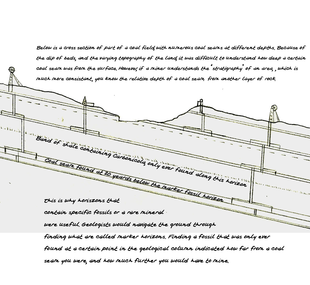
Finding a coal seam from the surface is quite difficult and coal prospectors would use geological stratigraphy to find important coal seams at depth: